A good shelter

Goederede in Dutch means “good shelter”. The medieval sailing ships were more or less forced to sail before the wind. The prevailing winds in the English Channel and the North sea are south-west to North-west. To sail out of the Rhine Delta or up the river after coming into the Delta, ships had to wait for favourable winds. This was done in the little shelter which the flat muddy island of Goeree south of Rotterdam could provide for the anchoring ships. A settlement was found to cater to the anchoring ships and it was aptly named Goedereede.

The market square in Goedereede

For that time the port was big and convenient. The place became important quite quickly and already in 1312 it was rewarded city rights which included the right to catch herring. A gate tower was built to protect the entrance to the port. In case of enemies approaching, chains could be spun between the towers of the gate to prevent them from sailing into the port. This gate still is the coat of arms of the town.


In 1453 the little town started to replace their little chapel with a representative church dedicated to St. Catharina, which in the subsequent years was successively enlarged. The nave of two aisles was attached to an enormous steeple which at the same time served as a lighthouse. It took from 1467 to 1512 to finish the steeple, however, the top was never put on.

Between 1492 and 1507 the pastor of the church was Adriaan Floriszoon Boeyens (Utrecht, 2.3.1459 – Rome, 14.9.1523). A statue next to the steeple announces that he was the only Dutch pope, Hadrianus VI, from 1522-1523. However, the future pope never lived in Goedereede. At the time he was part of the community of the Church of St.Pieter in Leuven in Belgium and taught at the university there. One of his disciples at the university was Erasmus of Rotterdam, and he also became one of the teachers of young prince Karl, son of Habsburg emperor Maximilian I, who later became emperor Karl V, the guy whose sun never set.

Statue in memory of Paus Hadrianus in Geodereede
The life of Adrian is quite fascinating. He was born in Utrecht as son of a carpenter who died when he was only 10 years old. His birthplace in Utrecht, which was later turned into a school for girls, still exists. The boy was intelligent and eager to learn and against all odds passed through different schools in the Netherlands until he begun to study in Leuven in 1476.

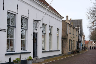
Entrance to the Paushuis in Utrecht
His friendship to Karl V. determined his career. He was entrusted with the sale of indulgences. One third of the money which people donated to save their souls was given to the pope in Rome, two thirds were to be used by Karl V to improve the dikes in the Netherlands. In 1515 Hadrianus was sent on a diplomatic mission to Spain, where he successively became bishop, cardinal and the head of the government after Karl was crowned emperor and moved to Belgium. In 1518 he also became the head inquisitor of Castilia and Leon. After the departure of Karl he stayed back in Spain alone. He had no experience in government and, as a foreigner, was not able to deal with the local politics. When an uprising started, he was not able to suppress it. Only after several pleas he was replaced by two Spanish rulers in 1520 but had to stay in Spain to fulfil his task as inquisitor.

The Paushuis in which the pope never lived
After 1517 and while in Spain Hadrianus had ordered to get a house built in Utrecht. He intended to move in there for his old days. However, he never even got to see his house. In 1521 he was nominated to become pope in Rome. He took more than half a year to decide whether to accept the nomination but eventually he sailed to Rome and was crowned in 1522.

Statue in memory of pope Hadrianus in Utrecht
In Rome he had to cope with a hostile population, corruption and chaos in the church, opposing political fractions backed by the French king Francois I on one side and emperor Karl V on the other side, the Turks in the east and the rise of Protestantism and Martin Luther in the North. In addition, the kitty of the papal state was empty since Hadrianus’ Medici predecessor had spent all the reserves on the splendid luxury of his court. One solution to earn money was the trade in indulgences, where Hadrianus already had some experience. That was exactly what Luther was opposed to. Luther said about the new pope:
“The Pope is a magister noster of Leuven, where even donkeys have the chance to acquire the doctorate. His words and actions are inspired by Satan.”

Statue in Goedereede
Hadrianus stayed pope for only a little more than one year. At age 64 he probably died from a kidney infection, and not, as frequently has happened, from poison. In spite of his short rule he already had aquired a nickname: “videbimus“, or “we shall see”. Hadrianus was the last non-Italian pope until the election of Polish Karol Józef Wojtyla in 1978.

The Gouden Leeuw at the market place to the right and the southern entrance to the port where a big port building used to stand
At the market in Goedereede, the “Gouden Leeuw”, built in 1482, after a big fire destroyed the town, is one of the oldest buildings in town. The building always served as a inn, originally for travelling salesmen and merchants. Today it is one of the oldest surviving hotels in the Netherlands. One of the hotel rooms is named after Adrianus Floriszoon Boeyens, the later pope, who was never here.

The gouden leeuw

The interior has preserved a lot of the original features and is at the same time stylish in a modern way. Like in many traditional old inns and merchant houses in the Netherlands there is a wooden balcony above the bar in the back of the guest room. On the walls, tasteful art and in the air, subtle and appropriate music. I arrive wearing a face mask shortly after the opening time at 10 am and I am the only guest. The friendly owner prepares my coffee and a piece of the typical apple pie. His regular coughs bring me back from medieval times into the age of a pandemic. He does not wear a mask. After a while his young help arrives. He had been at a boozing with his soccer club last night. Because everything has to close at 8 pm the 60 of them had to meet in a different room which had no windows open to the street. There had been around 25.000 daily positive tests in the Netherlands for the last week and the health care is at the brink of collapse.

The interior of the gouden leeuw
In the 16th century the tide turned in Goedereede. The entrances to the port started to silt up. Although as early as 1540 some measures were taken to prevent the silting of the harbour, by 1560, half of the population of the town had left. In addition, a series of floods covered the land around town. In 1570 a flood caused the collapse of a part of the gate tower protecting the entrance to the port. Eventually polders were created by building dykes. However, the consequence was that the canal linking the town to the sea became longer and longer. Goedereede lost its importance as a merchant port. Only fishing boats remained. But also merchants and artisans left. Their abandoned houses fell into disrepair and were demolished. The inhabitants turned to agriculture. The gaps in the city were filled with barns and sheds.

The backyards of the rich houses in Goedereede

The wooden barns

With the decline of the town also the big church went into dereliction. By 1706 the nave was in such a desolate state that it was demolished and replaced by a much smaller, free standing neo-gothic nave. The steeple remained and still towers above the town. The location of the former columns supporting the roof are indicated in the space between steeple and the baroque nave. The lower part of the northern wall of the nave is also preserved.

The new and old parts of the church

The wall remembering the former nave

In the second half of the seventeenth and in the eighteenth century the United Netherlands and England clashed in four Anglo Dutch wars over the supremacy of trade and rule over the oceans of the world. Fortifications were built to protect the many entrances of the river delta. Close to Goedereede an earthen defence structure was built in the seventeenth century to block passage of enemy ships into the Grevelingen part of the delta. The original structureof the so-called Schans was largely demolished in 1673. In 1795 it was rebuilt, now in a modern style. The earthen fortifications are still there today while the buildings which used to house the soldiers in the central courtyard are gone. A couple of old cannons decorate the bastions and remind of the former use. In the distance the steeple of the church of St. Catharine in Goedereede towers above the flat countryside.

The fortress guarding the entrance to the Grevelingenmeer

When the entrance for ships into the town became too difficult in the second half of the 19th century, the fishers of Goedereede decided to move to a new port at the seaside end of the canal. A new hamlet called Havenhoofd was found. The port in the town centre was only used occasionally by cargo ships.

The last windmill of Goedereede is also the last one in the Netherlands with an outside staircase to gain space for living quarters inside

Remainders of the medieval wall around Goedereede with a statue symbolizing the disposal of garbage across the walls
But the town was still close enough to the sea to harvest what was available. In 1918 a cargo ship was sunk by a torpedo of a submarine. In the middle of the great war, the ships precious cargo were barrels of port wine. The fishers of Goedereede succeeded in recovering 436 barrels. The wine was auctioned at the town’s market and gained 300.000 guilders. A third went to the fishermen, the rest into the treasury of the town. When two argue, the third laughs. The Netherlands were neutral in the first world war.

The canal linking Goedereede and Havenhoofd
In the second world war the Netherlands were quickly overrun by a German invasion in 1940. Despite its remote location a detachment of the German coast guard was deployed in Havenhoofd. Now the activities of the fishers were closely supervised. The fishermen had to be back at sunset and afterwards the entrance to the port was closed with a chain. The fish caught went to the German troops.

Havenhoofd
But it would get worse. With the threat of an allied invasion becoming more real, the fishing boats were confiscated. The attempt of building a defensive structure called the Atlantic wall along the entire coast from France to Denmark started with the deployment of an artillery detachment in Havenhoofd. For the construction of the Atlantic wall all the fishermens’ cottages were raised in 1943. The inhabitants had to find a refuge elsewhere. Only in 1947 the building of new replacement homes started. That is why there are no historic buildings in Havenhoofd.

Statue memorizing the discharge of fishing boats with baskets in Havenhoofd
However, with the construction of the Delta works, the flood gates protecting the southern Netherlands from the North sea, the port of Goedereede was finally closed and a thousand years of marine tradition came to an end.

The construction of the flood gates at the Haringvliet were the end of Havenhoofd-Goedereede as a seaport
When I come to Goedereede next time the corona regulations have been tightened. This time I enter the other cafe at the market square. Again I am the only one wearing a mask. They have not bothered to increase the distance between the tables to 1.5 m as required by the tightened regulations and the place is much smaller and lower than the Gouden Leeuw. Nobody wears a mask. They ask for the QR code certifying to be tested, recovered or vacinated but do ask any proof of identity as required by the regulations. The next guests who enter admit openly that they have no QR code. That is also OK for the staff, who will loose a big part of their income by the tightened regulations and therefore are grateful for any guest. Nobody asks me, the only other guest, whether I agree to sit close to somebody who might be infected.

The inner harbor in Stellendam
Today the seaport of the island of Goeree-Overflakkee, on which Goedereede is located, is closeby in Stellendam. The town has an outer harbour open to the tides and an inner harbour protected by the flood gates and accessible by locks. In the outer harbour, fishing boats moor in front of the “visafslag”, a huge building where the arriving fish is auctioned. A big part of the inner harbour is used for ship building.

Ships in the inner port of Stellendam
The entrance into the inner port is guarded by cameras which register license plates. A police car warily inspects the jetties. Since the big container ports are closely observed the drug smugglers have changed their tactics. Now the drugs are thrown overboard the big ships off the coast and small boats or fishing vessels pick up the contraband and bring it into minor ports where they attract less attention. It is a profitable but dangerous business for fishermen who suffer from reduced quota and overfished seas.

Fishing boats in the inner port...

...and the fish auction in the outer port
In some places history is so dynamic that it is surprising that anything from the past survives. Or, on the other hand, since economic and military attention turn away, old structures remain because nobody bothers or has the money to remove them.

The entrance to the ports of Stellendam
Another town with the name of Goede Reede was found on an island in a complete different part of the world. Dutch slave traders found a settlement on an island in the bay off Dakar in Senegal. Later the name was turned into French Goerée. This is part of a previous story:

Sources

"non omne quod minatur ferit"
("not everything that threatens strikes")
Relief in the courtyard of the Paushuis in Utrecht